88 South Antartic Traverse
Telah dilihat sebanyak 653 kali
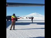
Deskripsi video:
For the second straight year, NASA researchers (Kelly Brunt and Adam Greeley) endured low temperatures, biting winds, and high altitude to conduct another 88-South Traverse. The 470-mile expedition in one of the most barren landscapes on Earth provides the best means of assessment of the accuracy of data collected from space by the Ice Cloud and land Elevation Satellite-2 (ICESat-2). The researchers drove tracked vehicles called PistenBullys, which were instrumented with GPS to collect highly precise elevation data along 88-degrees South, where ICESat-2's orbits converge. These data were then used to make direct comparisons with ICESat-2 elevation data. With a fast-firing laser instrument, ICESat-2 measures the elevation of ice sheets and tracks how much they change over time. Even small amounts of melt across areas as vast as Greenland or Antarctica can result in large amounts of meltwater contributing to sea level rise. To help document this, ICESat-2's height change measurements will have a precision of less than an inch - ground-truthed, in part, with efforts like this Antarctic campaign. The traverse was funded by NASA, but had substantial logistical support from the National Science Foundation Office of Polar Programs. Music: "Watching Evolution," "Formulas and Equations," Killer Tracks Music Complete transcript available.
Tertambah
15 Jan 2022
Komentar